
Walk a Junction City Street
A sound Junction City street directory search starts with the place, not a guess about a person. The Geary County Appraiser connects a situs address to a parcel and owner. The GIS viewer then places that parcel among the lots around it. Recorded instruments add the chain of title, while voter and historical sources may supply dated evidence of a person at an address. Each source answers a different question, so save its date and label.
- Enter the full current address in the ATCi Geary County parcel search. Save the parcel ID, Quick Ref, situs address, legal description, and owner name.
- Open the same parcel in the county GIS map. Move along the street one parcel at a time and keep parcel lines separate from the street image.
- Use the legal description and owner name at the Geary County Register of Deeds. Follow the newest deed back through each grantor and grantee.
- Check Kansas VoterView only for an individual match when the lawful purpose and identifying facts support it. It is not a public street roster.
- For a dated occupant clue, search a census street index, newspaper, telephone list, or physical directory through the library and archives.
The flow is address to parcel, parcel to legal description, legal description to deeds, then dated household evidence. A listed owner may receive mail elsewhere. A directory name may be decades old. Keeping those facts apart prevents the most common by-address mistake.
Junction City Address Search Fields
ATCi gives a street researcher far more than one address box. The county guide describes five main routes: address, KSPID, section-township-range, Quick Ref, and owner. If a normal Junction City spelling returns no result, the live city menu also contains the typo “Junction Ctiy” plus both “Fort Riley” and “FT RILEY.” Those exact portal values can solve a false zero-result search.
| Portal field | Input | Best street use |
|---|---|---|
| Property Situs Address | Text, optional | Find the parcel at the physical property address; test number and punctuation variants. |
| Owner Name | Text, optional | Enter last name then first name with no comma, as the county guide directs. |
| Parcel ID / Quick Ref | Text, optional | Use stable parcel keys when a street search is broad or ambiguous. |
| City | Dropdown, optional | Test Junction City, Junction Ctiy, Fort Riley, and FT RILEY where the record label is uncertain. |
| Subdivision / Block / Lot | Dropdown or text | Connect a civic address to the recorded plat and nearby lots. |
| Section / Township / Range | Text, optional | Find land that is easier to identify by survey description than by street. |
| Year / Sale Date / Value | Range controls | Narrow results, but do not treat the year menu as a record-coverage promise. |
Public parcel cards can show the situs address, mailing address, parcel ID, tract description, values, improvements, and some permit fields. Detailed sales data may require a login. The portal does not mark the displayed year range as the start of its historical records.
Records Along Junction City Streets
No record set is a complete street directory. Combining the sets below can establish ownership, location, recorded transfers, work on a parcel, and a dated personal link. The Geary County Register of Deeds has no public web index, which makes the office route an essential part of the chain.
| Address source | Custodian | Street evidence | Access route |
|---|---|---|---|
| Parcel card | Geary County Appraiser | Situs, owner, mailing address, parcel key, legal description, value, improvements | Free ATCi card; office or KORA request as backup |
| Parcel map | Geary County GIS | Parcel shapes, adjacency, subdivision and map context | ATCi or ArcGIS viewer; GIS office for help |
| Deeds and plats | Geary County Register of Deeds | Grantor, grantee, legal land description, book/page, easements, liens | Counter, office computer, phone preparation, or request for an existing record |
| Permits and applications | County Planning or Junction City | Named parcel, project, application, permit, or recorded plat material | Forms, SmartGov/MyGov, office contact, or a focused KORA request |
| Historical address sources | Library, GCHS, KSHS | Dated names, street references, census households, news, maps | Digital archive, reference help, research request, or reading room |
A current parcel card is the hinge. Its legal description leads to recorder books and plats. Its parcel ID helps retrieve older cards. The street spelling then supports newspaper and directory searches, but every historical result needs a year.
Note: Kansas VoterView verifies one registrant from name and birth date; it does not publish a by-street resident roll.
Map Junction City by Parcel
The Geary County ArcGIS viewer supports a visual pass along a named street. Select the target parcel, note its ID, and click each adjacent polygon. The county guide points to upper-right layers and parcel popups with current and prior-year card links. No one-click neighbor export is documented, so a careful street-by-street review means opening parcels one at a time.
Map geometry is useful context, not title proof. Geary County describes GIS as a tool for viewing and analyzing relationships, and ATCi warns that map data may be old or imprecise. Confirm a disputed boundary with a recorded plat or survey. External street imagery can also be wrong, so it should never replace the parcel popup or legal description.
Junction City Street Numbering
The Junction City property-numbering ordinance fixes the grid at First Street and Washington Street. East-west streets are measured from Washington, while north-south streets are measured from First. The rule calls for at least one number per 23 feet and sets odd-even orientation and corner rules. That system helps test whether a number fits the street grid.
The City Code Administrator may change a property number. A street-name change takes a written request, Commission action by ordinance, and notice to engineering, affected properties, and utilities. Research found no complete historical conversion table or verified citywide renumbering date. When an old number differs, preserve both forms and search Commission minutes, engineering records, newspapers, plats, and the recorder description before joining them.
Junction City Address Terms
Four terms keep a Junction City street directory search precise. Define them before copying a result into research notes, since postal routing and land records often describe the same place in different ways.
- Parcel
- A mapped unit of land with a county identifier. One street number can change while the parcel trail continues.
- Situs address
- The physical location assigned to the property, distinct from the owner’s mailing address.
- Plat
- A recorded map that lays out lots, blocks, streets, easements, and subdivision boundaries.
- Criss-cross directory
- A directory arranged by street and number rather than only by surname. No verified open Junction City run was found.
USPS can standardize a mailing address and ZIP+4, but it does not prove a person or firm is there. Likewise, a Junction City mailing label does not by itself prove the parcel sits inside the city limits.
Junction City Deeds by Address
The Geary County Register of Deeds expressly states that land records are not open through a public online search. Start with the Appraiser card, then bring the legal description, owner spelling, parcel keys, and any book/page reference to 200 E 8th Street. Staff can direct a search through name, numerical land, direct, indirect, or miscellaneous indexes.
The newest deed names the grantor, which becomes the next name to search backward. Repeat that process while checking plats, releases, mortgages, correction instruments, and adjoining descriptions. Before March 7, 1889, the county name was Davis County. Use both Davis and Geary labels for early instruments.
The official registered-access material describes office computer data from about 1992 and images from about June 17, 2002. Those are office-layer dates, not public-web coverage. The Register’s FAQ also points to 1800s records and early federal patent deeds, so older work depends on the counter and tract books.
The registered-user access page shows why the web search is not the full recorder route.
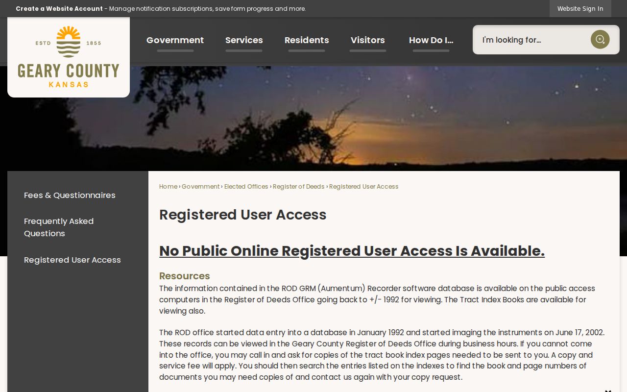
The captured county page documents the office-based access layer that follows a parcel-card search.
Junction City Plats and Permits
Recorded plats link a street address to its subdivision, block, lot, easements, and adjoining land. The county’s permit and application page provides routes for final plats, conditional uses, special exceptions, vacations, variances, and zone changes. Junction City SmartGov also offers parcel and document functions.
No complete public address-keyed permit or code-case results database was verified. Use the parcel number, address, permit type, and date span when contacting Planning/GIS/Zoning or filing a focused request for an existing record. KORA does not require an office to make a new list or answer a broad research question.
Older Junction City Street Clues
Historic maps and print sources can fill the gap after modern parcel research. The University of Kansas 1912 Sanborn set contains 14 sheets, and verified Junction City editions also include 1885, 1887, 1892, 1897, 1905, 1925, and later updates. A sheet can show the street form, building footprint, and use on its date. It cannot name the occupant.
Kansas Historical Society census materials include Junction City street-address indexes, while Dorothy Bramlage Library newspapers and yearbooks supply dated name and place references. No official site exposed an open reverse directory run. Ask the library about physical city or telephone books, then consult the Junction City city directory collections for cataloged years and companion sources.
Note: Keep the source year beside every old number, street spelling, map footprint, and directory name.
Junction City Filing Alerts
Geary County introduced a free Property Fraud Alert in 2026. Enrollment is available online or through the Register of Deeds office. The service can notify a subscriber when a filing matches the enrolled name. It does not establish fraud, cancel an instrument, or prove who occupies a property.
This timely records service complements a street directory search because it watches new recorder activity while the deed chain explains prior filings. Confirm any alert with the Register of Deeds and the recorded document itself.
Limits of Junction City Street Records
Public property records identify owners and land facts, not every person inside a home. A mailing address may differ from the situs. VoterView is an individual verification tool, not a street list. Driver data is restricted by federal law, and utility customer names should be treated as nonpublic unless a custodian identifies a specific open record.
A missing or conflicting address may reflect a parcel split, an old number, a Fort Riley label, a spelling variant, or protected information. Kansas Safe at Home supplies substitute addresses for eligible survivors. Do not try to defeat a protected address or combine scattered clues to expose one.
Use records lawfully. Junction City by-address records are for legitimate personal research. Never use an address trail to stalk, harass, intimidate, or harm anyone.